Science-Based Strategies for Mitigation, Emergency Response, and Building Resilience in a Changing Climate
Self-paced, Online, Lessons
Videos and/or Narrated Presentations
Approximate Hours of Course Media

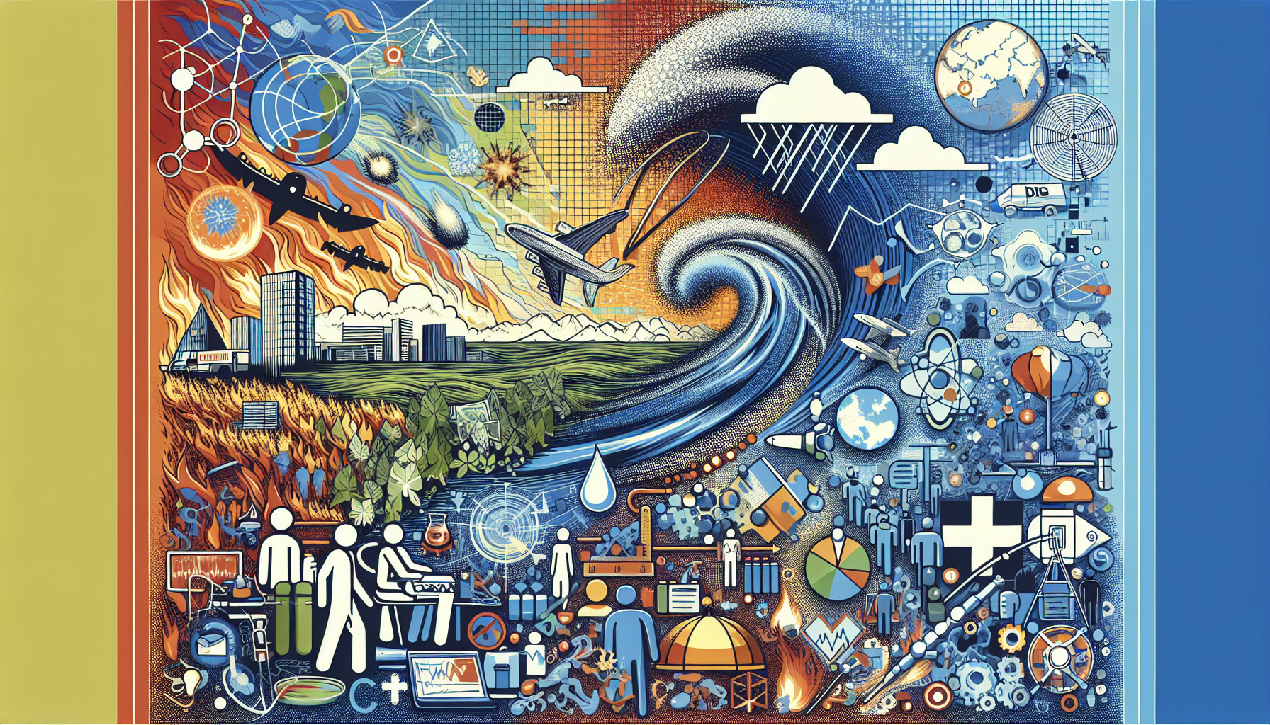
Natural Disasters and Preparedness is a comprehensive course designed to equip students with a deep understanding of various natural disasters and practical strategies for effective preparedness. Through this course, learners will gain essential knowledge to assess risks, plan responses, and contribute to building resilient communities, enhancing both personal and public safety.
Comprehensive coverage of natural disasters, their causes, impacts, and preparedness strategies.
This course begins with an introduction to the various types and causes of natural disasters, establishing a strong scientific foundation by exploring Earth’s structure, atmospheric conditions, and climate influences. Students will delve into common disasters such as earthquakes, hurricanes, floods, and wildfires, understanding the mechanisms and early indicators that precede these events.
Building on this scientific background, learners will explore the connection between climate change and the increasing frequency of disasters. The curriculum emphasizes practical applications, including risk assessment and hazard mapping to identify vulnerable zones, followed by disaster preparedness planning that equips students to create effective emergency response strategies.
Mitigation approaches are highlighted to teach methods for reducing disaster impacts, alongside the development of community resilience for stronger collective responses. Emergency management fundamentals cover essential roles, responsibilities, and communication tactics during crises, while the integration of technology showcases modern tools for monitoring and early warnings.
Incorporating case studies of major past disasters, the course provides valuable lessons and best practices. Additionally, it addresses the psychological and social effects of disasters, focusing on supporting mental health. Finally, students will explore future innovations and international collaboration efforts aimed at improving disaster mitigation worldwide.
Upon completing this course, students will have gained critical scientific knowledge, strategic planning skills, and practical tools necessary to respond effectively to natural disasters. They will emerge better prepared to assess risks, support community safety, and contribute meaningfully to reducing disaster vulnerabilities in their personal and professional lives.
In this lesson, you are introduced to natural disasters and their profound significance for human society and the environment. You will learn to differentiate between the main categories of natural disasters: geophysical, hydrological, meteorological, and biological. The lesson explores fundamental geophysical processes, including earthquakes driven by tectonic plate movements, and volcanic eruptions, focusing on magma ascent and eruption types. You will also study landslides, understanding their triggers such as heavy rainfall, earthquakes, and human activity.
Meteorological events such as hurricanes and tropical cyclones are examined, highlighting their formation over warm ocean waters, along with the dynamics behind tornadoes, including the role of supercell thunderstorms and wind shear. The lesson then explains the causes and characteristics of floods, distinguishing between flash floods and river floods, as well as the formation of droughts and their impacts on ecosystems and agriculture. You are introduced to tsunamis, emphasizing causes like underwater earthquakes, landslides, and volcanic eruptions, and explore heatwaves and cold spells as extreme weather events linked to atmospheric patterns.
Further, the lesson addresses natural and human factors behind wildfires and discusses disease outbreaks and pandemics as biological disasters shaped by environmental and social influences. You will grasp the concept of disaster magnitudes, recognizing how severity varies with hazard intensity and vulnerability. The role of climate change in altering the frequency, intensity, and geographic distribution of natural disasters is emphasized, alongside Earth's internal heat and plate tectonics as drivers of geophysical hazards.
The water cycle is introduced for its connection to meteorological hazards such as floods and droughts. The lesson underscores the critical importance of early warning systems in identifying the onset of various disasters. You will also appreciate the interconnectedness of natural disasters, such as how earthquakes can trigger tsunamis or landslides. Finally, the lesson highlights the scientific methods utilized in studying natural disasters, including remote sensing, seismology, and climatology, equipping you with a foundation to understand and engage with this dynamic field.
The lesson Earth Sciences Foundations: Understanding the Earth's Structure and Processes provides a comprehensive overview of the planet’s internal composition and dynamic mechanisms. It begins with an outline of the Earth's layered structure, detailing the crust, mantle, outer core, and inner core, emphasizing the distinct composition and physical properties that differentiate the Earth's crust from the mantle. The concepts of the lithosphere and asthenosphere are explored, highlighting their critical roles in driving tectonic activity. Students will learn how convection currents in the mantle serve as the engine for plate tectonics, facilitating movements that shape the planet's surface.
The lesson distinguishes between oceanic and continental crust, explaining how these differences influence geological processes such as subduction, which is pivotal in the generation of earthquakes and volcanism. Evidence supporting plate movement, including mid-ocean ridges and seafloor spreading, is examined, along with the mechanisms behind the formation of mountain ranges at convergent plate boundaries. Additionally, the characteristics of transform faults and their connection to earthquake activity are discussed, as well as the role of hotspots and mantle plumes in forming volcanic islands independent of plate boundaries.
The lesson also covers the sources of Earth’s internal heat, including radioactive decay and residual heat from its formation, which power many geodynamic processes. The elastic rebound theory is introduced as the fundamental explanation for earthquake generation. Students explore how the Earth’s magnetic field arises from the dynamo effect produced by the outer core. The rock cycle, encompassing igneous, sedimentary, and metamorphic processes, is reviewed to illustrate the continual transformation of Earth materials.
This lesson positions plate tectonics as the unifying theory that explains the global distribution of earthquakes, volcanoes, and mountain building. It highlights how Earth’s structural dynamics influence the patterns of natural disaster occurrence worldwide. The different types of seismic waves—P-waves, S-waves, and surface waves—are analyzed for the insights they provide into Earth’s interior structure. Moreover, the interaction between mantle plumes and large igneous provinces is linked to significant impacts on climate and ecosystems.
Finally, the relationship between Earth’s structure and the formation of tsunamis following undersea earthquakes is explained, alongside the critical role of geological faults in shaping landscapes and affecting human settlement risks. This foundational knowledge equips students with a deeper understanding of how the Earth's internal and surface processes are intertwined with natural disaster phenomena, enhancing preparedness and resilience strategies.
In this lesson, Weather and Climate Basics: How Atmospheric Conditions Affect Disasters, you will explore the fundamental differences between weather and climate, understanding that weather refers to short-term atmospheric conditions while climate represents long-term patterns. You'll learn how atmospheric pressure plays a crucial role in shaping local weather patterns and the formation of storms. The lesson also highlights the importance of temperature gradients in driving atmospheric circulation and the resulting weather systems. Additionally, the impact of humidity and atmospheric moisture on cloud formation and precipitation will be discussed. Wind patterns are critical in the development and movement of natural disasters such as hurricanes and tornadoes, and the interactions between oceans and atmosphere, exemplified by phenomena like El Niño and La Niña, significantly influence global weather extremes.
You will analyze the connection between jet streams and severe weather events, along with understanding the greenhouse effect and its role in shaping climate conditions. The lesson reviews how different climate zones affect the types and frequencies of natural disasters in various regions. Concepts such as atmospheric stability are explored to explain their influence on storm intensity and duration, while the development of drought conditions due to prolonged atmospheric patterns is examined for its disaster implications. The role of frontal systems in triggering severe weather like thunderstorms and tornadoes is also covered, as well as how seasonal changes impact the likelihood and nature of weather-related disasters.
Further, the lesson sheds light on the effect of urban heat islands in modifying local atmospheric conditions, increasing disaster vulnerability in cities. You will understand the concept of feedback loops between climate change and the escalating severity of weather disasters. The influence of atmospheric aerosols and pollution on weather patterns and disaster risk is discussed, alongside how rising sea surface temperatures intensify tropical cyclones and storm surges. The transport of atmospheric moisture in flooding events, the influence of topography on weather patterns and disaster occurrence in mountainous regions, and the overall importance of understanding atmospheric dynamics for improving disaster prediction and preparedness conclude the key points of this comprehensive lesson.
In this lesson, we explore common natural disasters including earthquakes, hurricanes, floods, and wildfires, emphasizing their growing significance in the context of climate change and expanding urban development. We begin by defining natural disasters and understanding how geological processes such as tectonic plate movements and the presence of fault lines cause earthquakes. The propagation of seismic waves during an earthquake and their varying impacts on structures highlight why certain regions are more vulnerable, especially in known earthquake-prone zones worldwide. The immediate hazards like ground shaking, surface rupture, and aftershocks are critical concerns following an earthquake.
Moving to hurricanes, the lesson explains their formation over warm ocean waters under specific atmospheric conditions. We delve into the structure of hurricanes, focusing on the eye, eyewall, and spiral rainbands, along with how the Saffir-Simpson scale categorizes storm intensity and potential damage. A special emphasis is placed on storm surge, often the deadliest hurricane component, and the advanced meteorological tools used to predict and monitor these storms in real-time.
Floods are another major focus, with distinctions drawn among riverine, flash floods, coastal floods, and urban flooding, which is influenced by land use changes. The lesson discusses how climate change affects flood frequency and severity, and the important role of floodplain dynamics, including natural wetlands and vegetation, in mitigating flood impacts.
Wildfires are examined by identifying both natural causes, such as lightning, and human ignition sources. We explain the influence of fuel load, weather, and topography on wildfire behavior and spread rates. The ecological consequences, including soil degradation, diminished air quality, and threats to biodiversity, are addressed alongside recent trends of increasing wildfire frequency and intensity linked to climate change and forest management practices.
The lesson concludes by highlighting the importance of integrated early warning systems tailored to each disaster type to enhance preparedness. It underscores the intersection of disaster science with community resilience, focusing on effective risk communication and the implementation of adaptive infrastructure. Finally, science-based mitigation strategies are outlined, such as earthquake-resistant construction, hurricane evacuation planning, comprehensive flood management systems, and wildfire fuel controls—essential measures for building resilience in a changing climate.
In this lesson, The Science Behind Natural Disasters: Mechanisms and Indicators, you will gain a comprehensive understanding of various natural disasters by exploring their fundamental causes and early warning signs. We begin by defining natural disasters, distinguishing between sudden-onset events like earthquakes and hurricanes, and slow-onset disasters such as droughts and landslides. The lesson then delves into the geophysical mechanisms behind earthquakes, focusing on tectonic plate movements and fault lines, as well as the formation of tsunamis triggered by underwater seismic activity and their spread across ocean basins.
Volcanic eruptions are examined next, highlighting magma dynamics, pressure buildup, and various eruption types. You will also learn about the formation of hurricanes, emphasizing key factors like ocean temperature, atmospheric conditions, and the Coriolis effect. The complex meteorological processes that lead to tornadoes within supercell thunderstorms are discussed, along with the causes of landslides, which depend on slope stability, soil saturation, and human influences.
The lesson further explains how floods result from heavy rainfall, river overflow, and the impact of urbanization on drainage systems, while droughts are linked to prolonged atmospheric pressure patterns and soil moisture deficits. There is a critical discussion on the role of climate change in altering the frequency and intensity of these natural disasters, highlighting the increasing challenges faced globally.
To help anticipate these events, the lesson identifies important geological indicators such as foreshocks and ground deformation that often precede earthquakes and volcanic eruptions. In the context of hurricanes, meteorological precursors like wind shear, sea surface temperature anomalies, and pressure gradients are examined. Early signs of landslides such as soil creep and tree tilting are also illustrated, providing insight into how subtle changes in the environment can signal impending disaster.
The use of remote sensing technologies is highlighted as a crucial tool for monitoring disaster-prone areas and detecting early warning signs. You will explore how ground subsidence and fissures might indicate potential sinkhole development, and the importance of historical disaster data in identifying patterns to better anticipate future occurrences. The lesson also covers chemical and physical changes in water bodies that might signal volcanic activity beneath lakes, as well as atmospheric humidity and temperature profiles that increase the risk of severe thunderstorms and tornadoes.
Finally, the significance of seismic waves in assessing earthquake magnitude and impact zones is discussed, alongside an outline of the basic principles behind disaster forecasting models used by scientists to predict event timing and severity. This comprehensive overview equips you with the scientific foundation necessary to understand natural disasters and their indicators, enhancing your preparedness and response strategies in the face of a changing climate.
The lesson Climate Change and Disaster Frequency: Exploring the Connection provides a comprehensive overview of how climate change—primarily driven by anthropogenic greenhouse gas emissions—is influencing the planet's environmental systems and increasing the occurrence of natural disasters. It begins by defining climate change and explaining the greenhouse effect, which plays a crucial role in Earth's energy balance by trapping heat in the atmosphere. As global temperatures rise, significant shifts occur in atmospheric and oceanic patterns, notably warmer sea surface temperatures that contribute to greater hurricane intensity and longer-lasting tropical cyclones. These temperature changes also fuel more extreme weather events, including altered precipitation patterns that heighten flood risks and prolonged droughts resulting from shifting climate zones.
The lesson highlights data trends that link increased wildfires to hotter, drier conditions, and underscores the threat posed by melting polar ice, which raises global sea levels and amplifies coastal disaster risks. In addition, climate change modifies the behavior of the jet stream, affecting storm tracks and contributing to more severe weather phenomena. Increased humidity and heat exacerbate the severity of heatwaves, while urban heat islands further intensify heat-related disasters in densely populated areas. The interplay between these factors creates feedback loops, such as permafrost thawing, which perpetuate and accelerate disaster frequency.
The course further explores how changing climate patterns influence the distribution and intensity of tornadoes and severe storms, and how shifts in snowpack and glacier melt impact freshwater availability and flood hazards. It also addresses the critical role of socioeconomic factors in shaping vulnerability to climate-driven disasters, emphasizing the necessity for integrating climate projections into disaster preparedness and emergency response planning. Finally, the lesson reviews recent case studies to illustrate real-world connections between climate change and natural disasters, reinforcing the importance of using science-based strategies for mitigation, emergency response, and building resilience in a changing climate.
In the lesson Risk Assessment and Hazard Mapping: Identifying Vulnerable Areas, you will explore the fundamental concepts of risk assessment and hazard mapping as essential components of natural disaster preparedness. These processes involve systematically identifying hazards, analyzing vulnerabilities, and evaluating exposure to understand and mitigate risks effectively. Recognizing vulnerable areas is crucial for implementing targeted disaster mitigation strategies. The lesson covers common natural hazards such as floods, earthquakes, hurricanes, and wildfires, highlighting how historical disaster data informs risk patterns and improves hazard maps. You will learn about the pivotal role of Geographic Information Systems (GIS) in spatial analysis and how remote sensing technologies enable real-time detection and assessment of hazards. Additionally, understanding the influence of topography and land use data helps pinpoint areas at risk, while social vulnerability factors like demographics, infrastructure quality, and economic status shape how communities are impacted.
The lesson also addresses how climate change is shifting hazard frequency, intensity, and geographic distribution, complicating risk assessment efforts. You will gain insight into multi-hazard risk assessments that consider overlapping vulnerabilities and learn about probabilistic risk assessment models used to predict hazard event likelihoods. Importantly, the integration of community input and indigenous knowledge enhances the accuracy and relevance of hazard maps. The course does not overlook the limitations and uncertainties present in risk assessments and highlights ethical responsibilities in communicating risk information to diverse populations.
Practical examples through case studies demonstrate how hazard mapping can successfully guide urban planning and emergency preparedness. You will understand how these maps support critical decision-making in resource allocation and response strategies. The importance of regularly updating hazard maps to reflect environmental changes and urban development is emphasized to maintain their effectiveness. Finally, the lesson underscores how risk assessment outcomes prioritize resilience-building measures and the necessity of interdisciplinary collaboration among scientists, policymakers, and local communities to produce comprehensive and actionable hazard mapping.
In the lesson Disaster Preparedness Planning: Creating Effective Emergency Plans, you will learn the fundamental concepts and practices essential for minimizing loss and accelerating recovery in the face of natural disasters. Disaster preparedness planning is defined as a critical process involving the development of comprehensive emergency plans tailored to various types of natural hazards. Key components include assessing risks to identify vulnerabilities within communities and households, and integrating input from local stakeholders and emergency agencies to ensure a coordinated approach. Hazard mapping plays a vital role in visualizing risks and shaping response strategies, while communication plans that incorporate alert systems and information dissemination are crucial for timely action.
Effective emergency plans must also outline clear evacuation routes and identify safe shelters, supported by detailed resource inventories such as food, water, and medical supplies to sustain prolonged responses. Coordination mechanisms among responders, government bodies, and community organizations enable efficient implementation, especially when multi-hazard scenarios are considered. To future-proof plans, integrating climate change projections and establishing contingency strategies for evolving disaster dynamics is essential. Public education campaigns further empower community readiness, with particular emphasis on accessibility for vulnerable populations.
Family emergency plans are highlighted to ensure individual preparedness, focusing on communication methods and designated meeting spots. The lesson also underscores the importance of training drills and simulations, which provide opportunities to validate and refine plans in realistic settings. Understanding the legal and policy frameworks influencing disaster preparedness enhances awareness of the regulatory environment. Technology, including mobile applications and GIS tools, supports real-time decision-making, while continuous plan evaluation ensures improvements based on lessons learned from past events. Finally, psychological preparedness and access to mental health resources are stressed as vital components of holistic disaster readiness.
In the lesson Mitigation Strategies: Reducing the Impact of Natural Disasters, you will learn how mitigation strategies are essential for minimizing both human and economic losses caused by natural disasters. These strategies begin with hazard mapping and risk assessment, which help identify vulnerable areas before disasters occur. Effective land-use planning and zoning laws prevent development in high-risk zones such as floodplains and fault lines, reducing potential damage. Building resilience is further enhanced through stringent building codes and construction standards, designed to withstand earthquakes, hurricanes, and floods. The lesson also introduces nature-based solutions, like restoring wetlands and mangroves, which serve as natural buffers against storm surges, alongside engineered infrastructure such as levees, seawalls, and dams that control flooding impacts.
You will explore the importance of early warning systems, which facilitate timely evacuations and preparedness, along with community-based mitigation programs that engage local populations in disaster risk reduction. Technological advancements like remote sensing and GIS improve disaster risk mapping and planning, while retrofitting techniques strengthen existing buildings to withstand future hazards. The role of insurance and financial instruments in lessening economic impacts and supporting resilient rebuilding is also highlighted. Moreover, regional and international cooperation is crucial for managing cross-border disaster risks and sharing best practices.
The lesson addresses how climate change is increasing the frequency and severity of natural disasters, making adaptive mitigation approaches necessary. Concepts such as resilient urban design, including green roofs and permeable pavements, help mitigate flood risks in cities. You will also learn about critical infrastructure protection, ensuring essential services continue during disasters, and the value of public education campaigns to promote safer behaviors and preparedness. The coordination role of emergency management agencies aligns mitigation with long-term sustainability goals.
Finally, the lesson covers the economic perspective by comparing costs and benefits of investing in mitigation versus disaster response and recovery. It presents examples of successful mitigation projects worldwide to demonstrate practical implementation and emphasizes the ongoing need for research and innovation to keep pace with evolving disaster risks. This comprehensive understanding equips you to appreciate how science-based strategies reduce disaster impacts and build community resilience in a changing climate.
The lesson on Community Resilience within the course Natural Disasters and Preparedness: Science-Based Strategies for Mitigation, Emergency Response, and Building Resilience in a Changing Climate provides a comprehensive understanding of how communities can strengthen their ability to withstand and recover from natural disasters and climate change impacts. It begins by defining community resilience in this specific context, emphasizing the critical role of strong social networks and community bonds in enhancing collective resilience. The lesson highlights the value of local knowledge and indigenous practices as key components of effective disaster preparedness, alongside resilient infrastructure design principles that help communities endure and bounce back from adverse events.
Equitable resource distribution is discussed as a fundamental factor influencing community vulnerability and capacity to respond, while the importance of reliable emergency communication systems is underscored in maintaining coordinated actions during crises. The role of local governance and robust policy frameworks in fostering resilience is examined, as is how economic diversification can reduce exposure to disaster risks by broadening livelihood options. The lesson also explores the impact of thoughtful urban planning and land use management on mitigating disaster effects.
Community education and awareness programs are presented as vital in preparing populations, and the concept of adaptive capacity is introduced to explain a community’s ability to adjust and thrive amid changing conditions. Mental health support systems are recognized for their role in aiding recovery, while the contribution of volunteer networks and community-based organizations during emergencies is analyzed. Students learn how climate projections inform risk reduction strategies, and the integration of technology such as GIS and early warning systems plays a crucial part in resilience building.
Engaging vulnerable populations in planning processes ensures inclusivity and effectiveness, and the effectiveness of public-private partnerships in advancing disaster resilience is discussed. Through the analysis of case studies, students see practical examples where resilience-building strategies have successfully reduced disaster impacts. The lesson concludes by exploring funding mechanisms and grants that support resilience projects, and stresses the importance of continuous monitoring and feedback to adapt and improve community resilience efforts over time.
The lesson Emergency Response Fundamentals: Roles, Responsibilities, and Communication provides a comprehensive overview of the critical components that underpin effective disaster response. It begins by defining the concept of emergency response and emphasizing its vital importance during natural disasters. Students learn about the structured hierarchy of emergency response organizations spanning local to federal levels, as well as the distinct roles and responsibilities of frontline personnel such as firefighters, EMS, and law enforcement. The function of Emergency Operations Centers (EOCs) is highlighted as central to coordinating efforts, alongside the significance of the Incident Command System (ICS) in efficiently managing resources and personnel.
Attention is given to the duties of public health officials and the valuable support provided by community leaders and volunteers. The important contributions of non-governmental organizations (NGOs) and charities in emergency relief are also examined. A key focus of the lesson is the necessity for multi-agency collaboration and robust interagency communication to ensure cohesive responses. Students explore the critical nature of communication channels and tools, and learn about common challenges faced such as language barriers, misinformation, and technological failures.
The role of social media and digital platforms in rapidly disseminating emergency information is discussed, along with protocols for emergency alerts and warnings that ensure timely public notification. The lesson further explains how crisis communication teams manage public information and media relations during disasters. Responsibilities regarding evacuation planning and shelter management are outlined, with emphasis on how cultural competence enhances communication and service delivery in diverse communities. Mental health support services for both responders and affected populations are recognized as a crucial element of comprehensive emergency care.
Finally, the lesson covers the legal and ethical responsibilities of responders, stressing the importance of continuous training and drills to boost preparedness and response effectiveness. Clear role definitions are underscored to prevent duplication of efforts or gaps in the emergency response system. Altogether, this lesson equips students with a foundational understanding of the multifaceted roles, responsibilities, and communication strategies essential for effective emergency response in the context of natural disasters and climate change.
The lesson Technology in Disaster Management: Tools for Monitoring and Early Warning explores the critical role of advanced technologies throughout the various phases of disaster management: preparedness, response, recovery, and mitigation. Central to disaster planning is the use of Geographic Information Systems (GIS), which enable precise mapping of hazards and vulnerabilities, enhancing situational awareness. Remote sensing satellites provide continuous, real-time monitoring of environmental changes, vital for tracking natural disasters as they unfold. Complementing this are weather radar systems, instrumental in detecting severe storms and issuing timely early warnings to communities at risk.
The integration of Internet of Things (IoT) sensors allows for real-time data collection on critical parameters such as rainfall, river levels, and seismic activity, facilitating rapid decision-making. Additionally, social media platforms serve as powerful tools for disseminating disaster warnings quickly while enabling community feedback to improve response strategies. The use of artificial intelligence (AI) and machine learning algorithms further enhances predictive capabilities by analyzing complex datasets to forecast disaster events more accurately.
On the user side, specialized mobile apps offer personalized and community-focused alerts, evacuation routes, and preparedness information, empowering individuals in disaster scenarios. Unmanned aerial vehicles (drones) contribute significantly by providing detailed assessments of disaster site damage and increasing situational awareness for emergency teams. A well-designed Early Warning System (EWS) relies on a coordinated architecture of components, communication channels, and integration with community stakeholders to maximize effectiveness.
The lesson also highlights ocean-based technologies like tsunami detection buoys and other sensors that monitor seismic sea waves in real-time, as well as seismic network technologies that enable rapid earthquake detection and alert dissemination. Flood forecasting models combine hydrological and meteorological data for accurate prediction and preparedness. Handling massive amounts of data is made possible by cloud computing, which supports extensive storage and processing needs in disaster monitoring systems.
Emerging technologies such as blockchain offer promising potential for secure and transparent management of aid distribution and resources during crises. Satellite-based vegetation monitoring plays an essential role in the early detection of droughts and wildfires. The lesson also addresses the challenges faced by remote or low-resource communities in adopting these advanced technologies and discusses strategies for overcoming these barriers to ensure wider accessibility.
Another key topic is the importance of interoperable systems that facilitate efficient data sharing among agencies and international disaster response teams, essential for coordinated action. Ethical considerations around data collection, privacy, and the responsible use of technology in disaster management are emphasized, reflecting the need for careful governance. Finally, future trends such as the use of virtual reality (VR) and augmented reality (AR) for training and disaster simulation offer innovative avenues for enhancing preparedness and resilience in the face of increasingly complex natural hazards.
This lesson on Case Studies of Major Disasters provides a comprehensive examination of diverse natural and biological disasters, emphasizing the critical lessons learned and best practices that have enhanced mitigation, emergency response, and resilience building. Beginning with an overview of case study methodology, students explore how detailed analyses of major events reveal systemic strengths and weaknesses.
Key case studies include the 2004 Indian Ocean Tsunami, highlighting failures in early warning systems and subsequent innovations, and Hurricane Katrina (2005), which serves as a poignant lesson in the breakdown of emergency response coordination and the importance of federal-state-local communication. The 2011 Tōhoku Earthquake and Tsunami demonstrate the integration of seismic data with evacuation planning and resilient infrastructure design, while the Australian Bushfires (2019-2020) illustrate effective community engagement and wildfire risk reduction strategies.
The lesson also covers the critical role of geographic information systems (GIS) in mapping disaster impacts and optimizing response efforts. Engineering advances are discussed through the lens of the 1985 Mexico City Earthquake, which propelled evolution in building codes to enhance seismic resilience. Community-based adaptation methods are explored with the example of recurring flooding in Bangladesh, emphasizing local approaches to riverine flood management.
Preparation for volcanic hazards is illuminated by lessons from the 1980 Mount St. Helens eruption, focusing on hazard communication, while the COVID-19 pandemic is evaluated as a biological disaster that intersects with natural disaster preparedness frameworks. The challenges of rubble removal and temporary shelter logistics come into focus with the 2010 Haiti Earthquake, and the increasing influence of climate change on disaster frequency and severity is underscored by global examples.
The 2018 Sulawesi earthquake and tsunami case demonstrates the shaping of integrated disaster risk reduction policies, and the vital role of social media and real-time data sharing in recent hurricane responses highlights evolving communication landscapes. Economic impacts are analyzed through the 2017 Central Mexico Earthquake, while mental health services' importance in recovery is stressed with post-Katrina interventions.
Additionally, the lesson incorporates indigenous knowledge from Pacific island communities as valuable contributions to disaster resilience. The 2019 Cyclone Idai in Mozambique exemplifies international humanitarian collaboration and logistical complexities. Advances in structural engineering and retrofitting techniques are examined across multiple earthquake case studies, and contrasting responses in urban versus rural settings offer insights into tailored preparedness approaches.
Overall, this lesson equips students with an in-depth understanding of how real-world disaster experiences inform science-based strategies for effective mitigation, response, and resilience in a changing climate.
In this lesson, we begin by defining psychological trauma and the common mental health impacts experienced during and after natural disasters, including the concept of acute stress reaction and its typical symptoms in disaster survivors. We explore long-term psychological conditions such as PTSD, depression, and anxiety that are linked to disaster exposure. Special attention is given to the impact on vulnerable populations like children, the elderly, and people with disabilities, highlighting how social isolation during disasters can exacerbate these challenges. The lesson also identifies key social determinants that influence mental health outcomes in disaster-affected communities and investigates factors of community resilience that help buffer psychological stress post-disaster.
The importance of social support networks is emphasized as critical in fostering recovery and coping mechanisms, while the effects of displacement and loss of home on individuals’ identity and mental wellbeing are reviewed. We discuss how cultural influences shape the interpretation and expression of psychological distress after disasters. Furthermore, integrating mental health services into emergency response plans is underlined as essential to comprehensive care. The lesson introduces Psychological First Aid (PFA) as an evidence-informed approach to support disaster survivors, detailing the roles non-mental health professionals can play in providing basic psychological support during crises.
Challenges in delivering mental health care in resource-limited disaster settings are assessed alongside the increasing use of tele-mental health interventions during and after disasters. The lesson explores the stigma surrounding mental health that can prevent affected individuals from seeking help and discusses strategies for training first responders and community leaders in mental health awareness. We also analyze the psychological impact on emergency responders and identify risk factors for burnout.
Finally, the lesson examines how ongoing climate change influences the frequency and severity of disasters, which in turn shapes mental health risk profiles. It concludes by emphasizing the critical role of multidisciplinary collaboration in providing comprehensive mental health support during both disaster preparedness and response, ensuring that communities are equipped to build resilience in the face of increasing natural hazards.
The lesson Future Trends in Disaster Mitigation: Innovations and Global Collaboration explores the numerous emerging technologies that are transforming disaster mitigation in the 21st century. Central to this transformation is the role of artificial intelligence and machine learning in enhancing predictive modeling for natural disasters, allowing for more accurate forecasts and timely preparedness. Advances in remote sensing and satellite imagery provide real-time hazard monitoring capabilities, while the use of drones facilitates rapid damage assessment and emergency supply delivery. The integration of Internet of Things (IoT) devices is pivotal in developing resilient infrastructure systems, particularly within smart cities that harness sensor networks to implement effective early warning systems.
Innovations in flood control, such as nature-based solutions and adaptive engineering, complement the development of resilient building materials and advanced construction techniques designed to withstand extreme weather events. The power of big data analytics optimizes emergency response logistics and resource allocation, while blockchain technology ensures secure and transparent distribution of disaster aid. On a global scale, communication platforms enhance rapid information sharing among international responders, and public-private partnerships play a critical role in driving innovation throughout disaster preparedness and recovery efforts.
The lesson emphasizes the importance of collaborative international frameworks that support disaster risk reduction and climate adaptation. Climate forecasting is highlighted as essential in shaping future mitigation policies, alongside cross-border data-sharing initiatives designed to improve transnational disaster response coordination. Emerging financial tools, including catastrophe bonds and climate risk insurance, offer innovative mechanisms to support mitigation funding. Importantly, the integration of indigenous knowledge and active community participation within technological frameworks enhances the relevance and effectiveness of mitigation strategies.
Ethical considerations are addressed regarding the deployment of surveillance and data collection technologies during disasters, balancing privacy and security concerns. The lesson also discusses challenges and opportunities involved in scaling promising pilot innovations to global implementation. Finally, it explores future directions such as the incorporation of virtual and augmented reality technologies to enhance disaster preparedness training, ensuring that responders and communities are better equipped to handle the increasing risks associated with a changing climate.
Meet your instructor, an advanced AI powered by OpenAI's cutting-edge o3 model. With the equivalent of a PhD-level understanding across a wide array of subjects, this AI combines unparalleled expertise with a passion for learning and teaching. Whether you’re diving into complex theories or exploring new topics, this AI instructor is designed to provide clear, accurate, and insightful explanations tailored to your needs.
As a virtual academic powerhouse, the instructor excels at answering questions with precision, breaking down difficult concepts into easy-to-understand terms, and offering context-rich examples to enhance your learning experience. Its ability to adapt to your learning pace and preferences ensures you’ll get the support you need, when you need it.
Join thousands of students benefiting from the world-class expertise and personalized guidance of this AI instructor—where every question is met with thoughtful, reliable, and comprehensive answers.